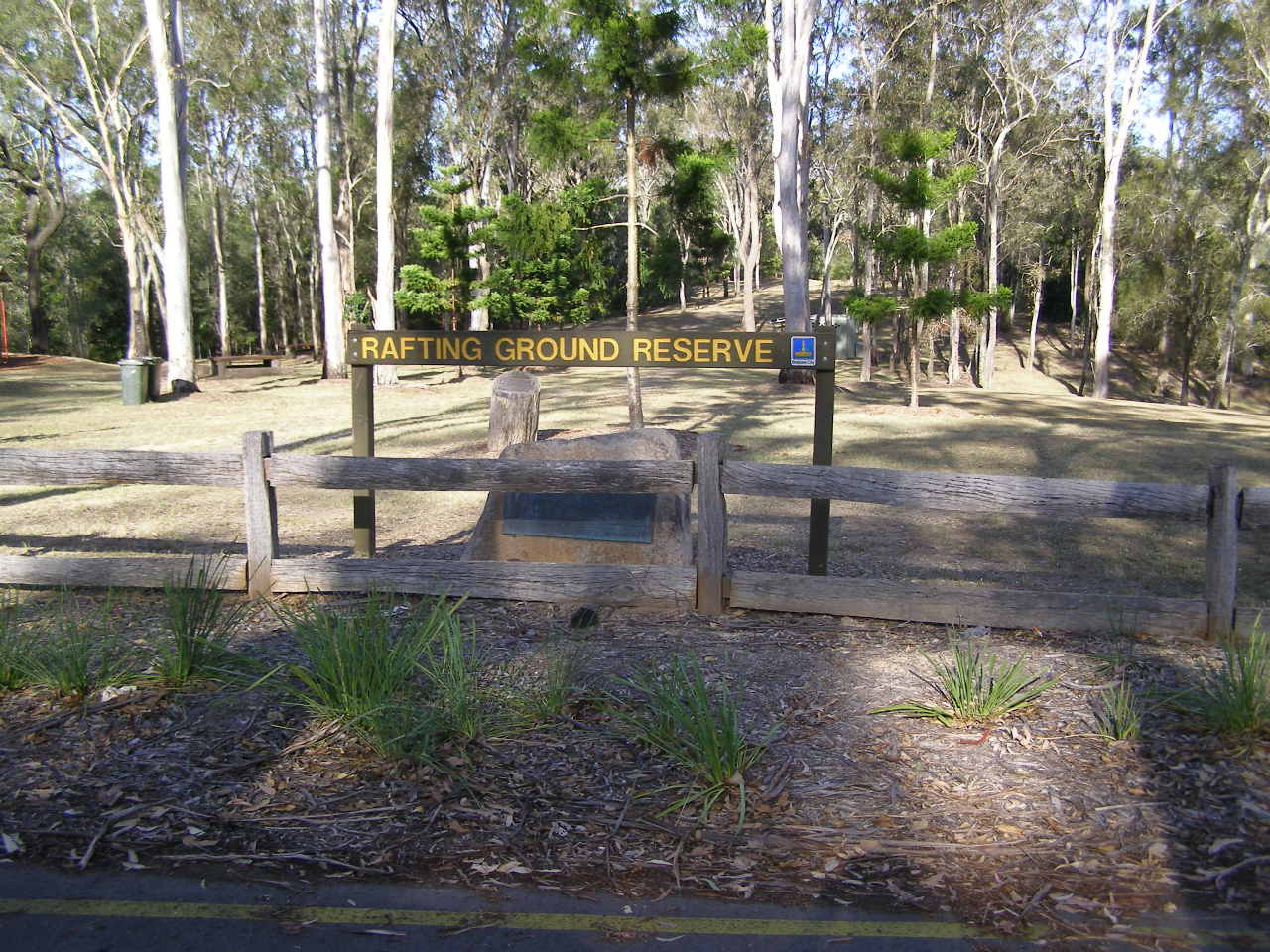
Pullenvale Rafting Ground reserve

Pullenvale Rafting Ground reserve
Origin of Name - Rafting Ground

Pullenvale Rafting Ground reserve
Pullenvale Rafting Ground reserve
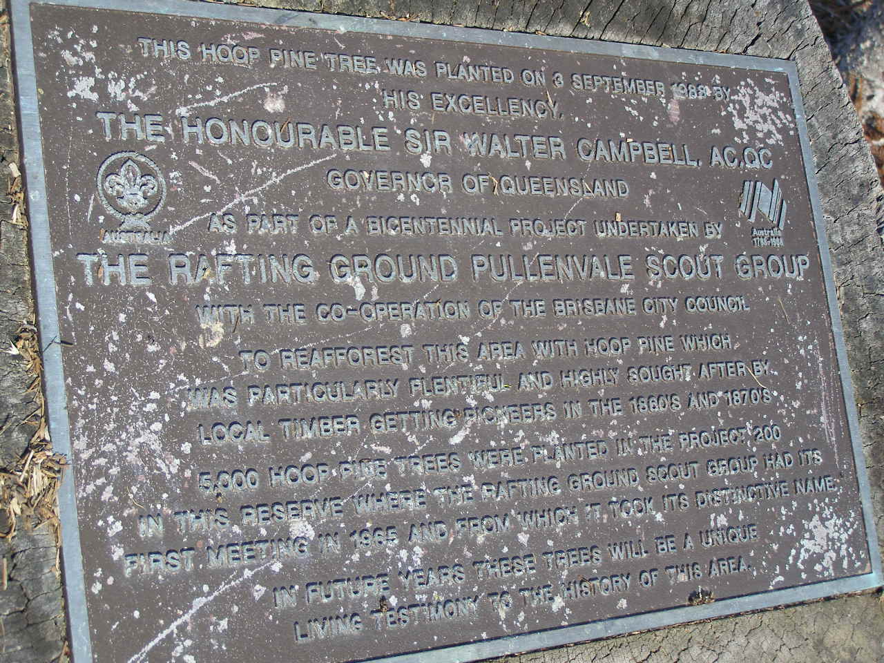
Hoop pine planting by the Rafting Ground Pullenvale Scout Group
Pullenvale Rafting Ground reserve

Pullenvale Rafting Ground reserve
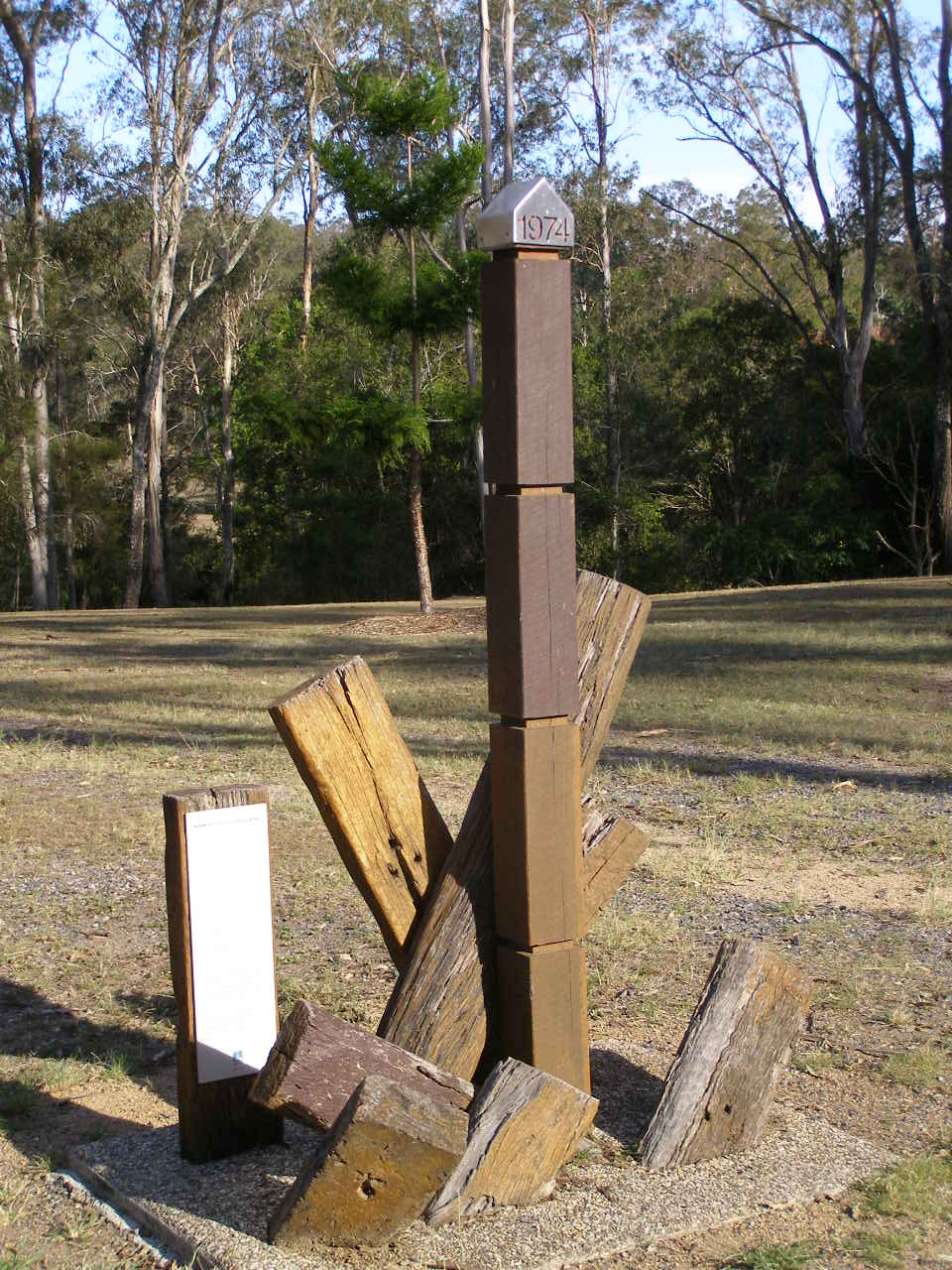
marker - 1974 flood level
(site of) Pullenvale Rafting Ground cemetery, Brisbane

1893 flood map of Pullenvale road and Rafting Ground showing cemetery reserve.
(site of) Pullenvale Rafting Ground cemetery, Brisbane

2021 google maps view of Pullenvale road and Rafting Ground, with marker for Pullenvale Recreation Reserve being in approximate position of cemetery reserve marked in 1893.
(site of) Pullenvale Rafting Ground cemetery, Brisbane

2021 google maps view of Pullenvale road and Rafting Ground, with marker for Pullenvale Recreation Reserve being in approximate position of cemetery reserve marked in 1893.
(site of) Pullenvale Rafting Ground cemetery, Brisbane
From "Mud maps of Moggill", compiled and edited by Libby Wager in association with the Pullenvale field study centre 1988

From "Mud maps of Moggill", compiled and edited by Libby Wager in association with the Pullenvale field study centre 1988
Early maps show that the Temporary Reserve for rafting was on Pullenvale Road, just past the present Moggill Road intersection. Moggill (Old) Cemetery was later situated withing its boundaries.
From "Mud maps of Moggill", compiled and edited by Libby Wager in association with the Pullenvale field study centre 1988
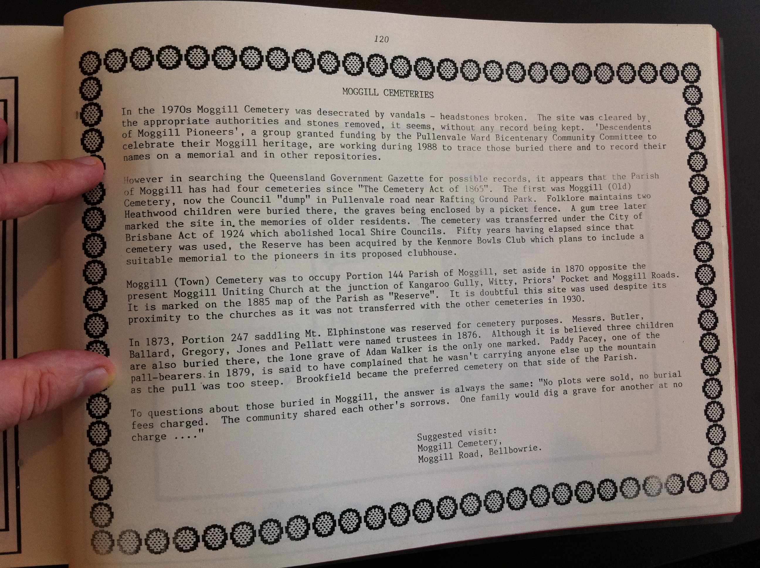
In the 1970s Moggill Cemetery was desecrated by vandals - headstones broken. The site was cleared by
the appropriate authorities and stones removed, it seems, without any record being kept. 'Descendents
of Moggill Pioneers' a group granted funding by Pullenvale Ward Bicentenary Community Committee to
celebrate their Moggill heritage, are working during 1988 to trace those buried there and to record their
names on a memorial and in other repositories.
However in searching the Queensland Government Gazette for possible records, it appears that the parish
of Moggill has had four cemeteries since the "Cemeteries act of 1865". The first was Moggill (Old)
Cemetery, now the Council "dump" in Pullenvale road near Rafting Ground Park. Folklore maintains two
Heathwood children were buried there, the graves being enclosed by a picket fence. A gum tree later
marked the site in memories of older residents. The cemetery was transferred under the City of
Brisbane Act of 1924 which abolished local Shire Councils. Fifty years have elapsed since that
cemetery was used, the Reserve has been acquired by the Kenmore Bowls club which plans to include a
suitable memorial to the pioneers in its proposed clubhouse.
Moggill (Town) Cemetery was to occupy Portion 144 Parish of Moggill, set aside in 1870 opposite the present Moggill Uniting Church at the junction of Kangaroo Gully, Witty, Prior's Pocket and Moggill Roads.
It is marked on the 1885 map of the parish as "Reserve". It is doubtful this site was used despite its
proxility to the churches as it was not transferred with other cemeteries in 1930.
In 1873, Portion 247 saddling Mt Elphinstone was reserved for cemetery purposes. Messrs. Butler, Ballard, Gregory, Jones and Pellatt were named trustees in 1876. Although it is believed three children are also buried there, the lone grave of Adam Walker is the only one marked. Paddy Pacey, one of the
pall-bearers in 1879, is said to have complained that he wasn't carrying anyone else up the mountain
as the pull was too steep. Brookfield became the preferred cemetery on that side of the parish.
To question about those buried in Moggill, the answer is always the same "No plots were sold, no burial
fees charged. The community shared each other's sorrows. One family would dig a grave for another at no charge ..."
suggested visit
Moggill Cemetery
Moggill Road, Bellbowrie
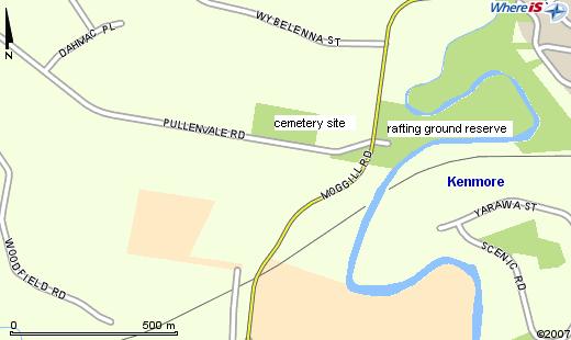
estimated location of early cemetery site at Rafting Ground.